GPSit: Essential mapping tech deployed in cyclone clean-up
"Getting a clear idea of what needs to happen is incredibly useful for our customers to plan their recovery efforts,"
– Matt Flowerday - Founder of GPSit
Pioneering New Zealand farm and orchard mapping company, GPSit, is playing a critical role in helping their customers in the central North Island recover following the devastation of Cyclone Gabrielle.
"We can locate properties, estimate the impact of the cyclone on the land, and provide dashboards for our clients very quickly after the weather event."
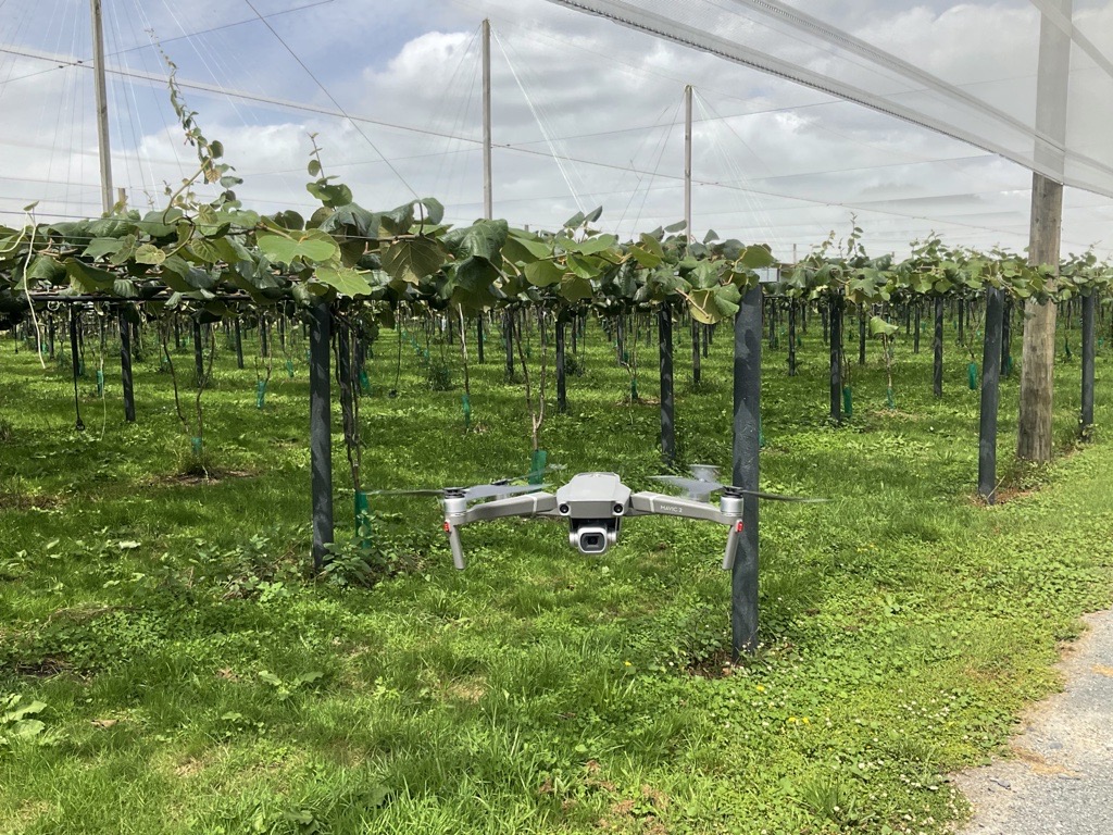
Founded over 20 years ago, GPSit provides state-of-the-art virtual maps to Aotearoa's horticulture and agriculture sector, for everyone from Mum-and-Dad farms to household names like Fonterra. They build their maps with data and images from satellites and Unmanned Aerial Vehicles (UAVs, also known as drones).
These maps enable GPSit’s customers to make informed decisions about their day-to-day farm management and long-term crop planning. Customers also use these maps to help meet environmental compliance (notably the Farm Environment Plan) and communicate health and safety hazards to their team. They have proven particularly useful when land is not easily accessible or farm labour is tight at busy times of year.
As the cyclone clean-up continues and new light is shed on the extent of the damage, GPSit is ready to continue supporting the region's farmers and growers by mapping the scale of silt coverage and monitoring the removal progress.
 GPSit has also developed Landkind, a digital platform designed to empower growers and packhouses by streamlining the visualisation, management, and optimisation of orchards through a single, comprehensive tool.
“Landkind's vision is to assist growers in monitoring the impact of the cyclone on future crops, and help to collate data to assist in future management decisions," founder Matt Flowerday says.
Landkind has mapped 500,000 hectares of land across New Zealand, working with organisations such as Zespri, New Zealand Apple and Pears, and several Regional Councils.
Flowerday is now setting his sights on the global market, having attended the Agritech Activator's South Australian market immersion this February.
"The great thing about GPSit’s offering is that it isn't limited to New Zealand and works with more than one crop… We can seamlessly adapt our tech to map farms and orchards in Australia or the US. The team is looking forward to forming global partnerships and collaborating with other companies. From these new partnerships, we hope to combine datasets and provide actionable insights to benefit growers," says Flowerday.
"There are significant opportunities in the international market, with agritech playing a crucial role in addressing climate change, sustainability, and food security. GPSit understands agriculture's challenges, such as rising input costs and regulatory compliance, and advocates for collaboration between technology partners and data providers to harness available data and generate actionable insights for growers.”
Learn more about GPSit here:https://gpsit.co.nz/